
Accurate measurements are essential at every stage of building construction, renovation and maintenance. Before preparing architectural drawings, modifying an existing structure or planning a major renovation, architects and engineers need reliable information about the actual site conditions.
Traditional building surveys generally use measuring tapes, laser distance meters, levels, total stations and other instruments. These methods remain important, but measuring complex buildings manually can take considerable time. Irregular walls, curved surfaces, concealed structural details and difficult-to-access areas can also make data collection challenging.
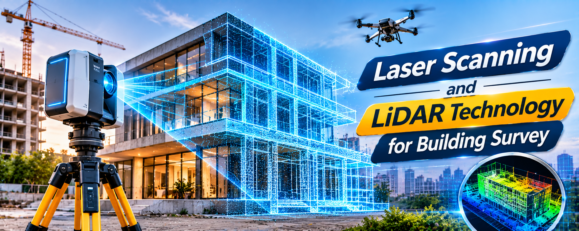
This is where Laser Scanning and LiDAR Technology are changing the way building surveys are carried out.
These technologies capture large amounts of spatial information and help create detailed digital representations of buildings. Instead of recording only selected dimensions, a scanner can capture millions of measurement points representing walls, floors, ceilings, columns, openings and other visible surfaces.
The collected information can then be processed into point clouds, 3D models, floor plans, sections and other technical outputs.
For architects, structural engineers, contractors, developers and property owners, this technology can improve documentation, support renovation planning and help identify differences between design drawings and actual site conditions.
Let’s understand how laser scanning and LiDAR work, where they are used, their benefits, limitations and importance in modern building surveying.
What Is Laser Scanning in Building Surveying?
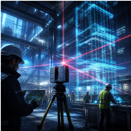
Laser scanning is a measurement technique that uses laser light to capture the position of physical surfaces in three-dimensional space.
A scanner sends laser pulses or beams towards surrounding objects and measures the returned signals. Using this information, the instrument calculates the distance and spatial position of points on the scanned surfaces.
When a building is scanned, the instrument can record thousands or millions of points across visible areas. These points collectively form a point cloud, which represents the building’s geometry.
A point cloud can capture details such as:
Wall positions and dimensions.
Floor and ceiling levels.
Column and beam locations.
Door and window openings.
Staircases and corridors.
Roof shapes and structural profiles.
Facade details and surface irregularities.
Visible building services and equipment.
The resulting data can be used to prepare accurate existing-condition drawings and digital building models.
What Is LiDAR Technology?
LiDAR stands for Light Detection and Ranging. It is a remote-sensing technology that uses laser light to measure distances and capture information about surrounding objects.
A LiDAR system emits laser pulses and measures how long they take to return after reflecting from surfaces. This information helps calculate distances and create spatial measurements.
LiDAR is used in several industries, including:
Building and architectural surveying.
Land and topographic surveying.
Road and infrastructure development.
Forestry and environmental mapping.
Mining and quarry surveys.
Transportation and autonomous systems.
Heritage documentation.
In building surveying, LiDAR can be used to capture the geometry of building interiors, exteriors and surrounding areas.
It may be installed in terrestrial scanners, mobile mapping systems, drones or handheld devices. The suitability of each system depends on the required accuracy, scanning distance, environment and project size.
Important distinction: Laser scanning and LiDAR are closely related terms, but they are not always interchangeable. LiDAR describes a distance-measurement technology, while laser scanning refers more broadly to the process of capturing spatial information using a scanning instrument. Some building scanners use LiDAR principles, while others use different laser measurement methods.
How Do Laser Scanning and LiDAR Work?
The basic process involves capturing physical measurements, processing the collected information and converting it into useful digital outputs.
Step 1: Site Inspection and Survey Planning
Before scanning begins, the survey team studies the building and identifies the areas that need to be documented.
The team considers:
Building size and layout.
Indoor and outdoor scanning requirements.
Accessibility of different spaces.
Required measurement accuracy.
Areas with limited visibility.
Required coordinate system and reference points.
Final deliverables, such as point clouds or BIM models.
Planning helps determine how many scanning positions are needed and where the equipment should be placed.
Step 2: Scanning the Building
The scanner is positioned at selected locations around or inside the building.
It emits laser pulses or beams and records the returned measurements. By capturing multiple directions, the equipment builds a detailed representation of visible surfaces.
For large buildings, several scanning positions may be necessary because walls, columns and other objects can block the scanner’s view.
Step 3: Registration of Scan Data
Individual scans are often captured from different positions. These datasets must be aligned to create one consistent representation of the building.
This process is called registration.
Surveyors may use common features, reference targets or surveyed control points to combine the scans.
Accurate registration is important because poorly aligned scans can create incorrect dimensions and misleading geometry.
Step 4: Point Cloud Processing
After registration, the collected data is processed using specialised software.
The team may remove unwanted points, separate building elements, classify surfaces and check the quality of the dataset.
The result is a cleaner and more usable point cloud.
Step 5: Create 2D Drawings or 3D Models
The processed data can be used to create:
Existing-condition floor plans.
Building elevations.
Cross-sections.
Ceiling plans.
3D architectural models.
Structural reference models.
Scan-to-BIM documentation.
The final output depends on the project requirements and the level of detail requested by the client.
Types of Laser Scanning and LiDAR Equipment Used in Building Surveys
Different scanning systems are available depending on the building size, project requirements and required level of detail.
1. Terrestrial Laser Scanners
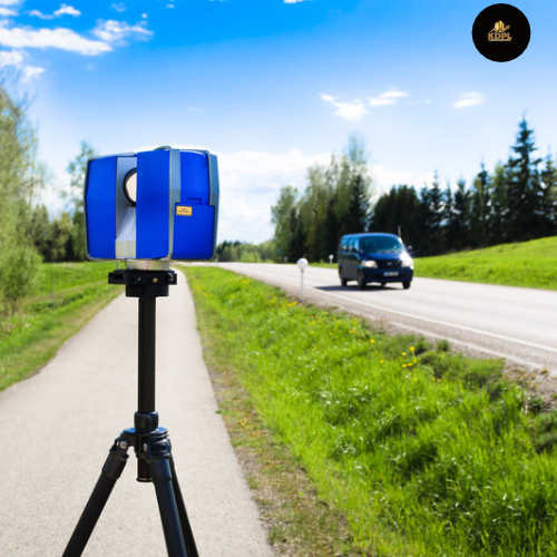
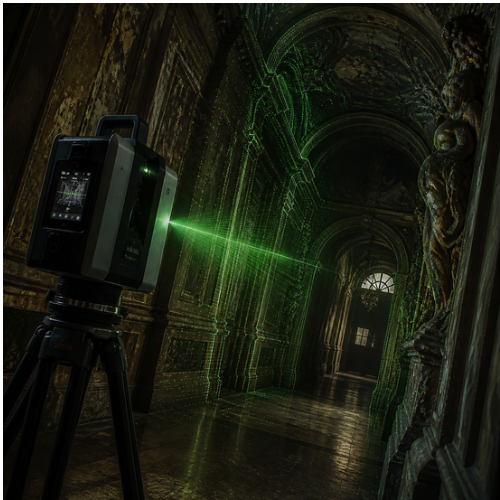
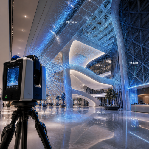
Terrestrial laser scanners are mounted on tripods and commonly used for detailed building surveys.
They are suitable for capturing building interiors, facades, structural elements, industrial facilities and complex architectural spaces.
Common applications:
Existing building documentation.
Industrial building surveys.
Heritage building recording.
Structural geometry assessment.
Detailed facade measurements.
2. Mobile Laser Scanners
Mobile scanners capture spatial information while the equipment is moving. They may be handheld, mounted on a trolley or attached to a vehicle.
These systems can help survey large buildings, corridors, commercial facilities and extensive indoor environments.
However, the final accuracy depends on the equipment, tracking method, movement conditions and survey control.
3. Drone-Based LiDAR Systems
LiDAR sensors can be mounted on drones to collect spatial information from elevated or difficult-to-access areas.
They are useful for surveying:
Building roofs.
Large industrial properties.
External building surroundings.
Complex roof structures.
Large infrastructure sites.
Drone surveys require suitable flight permissions, safe operating conditions and appropriate control measurements. They are not a direct replacement for detailed interior scanning.
4. Handheld and Smartphone LiDAR Devices
Some handheld devices and smartphones include LiDAR sensors that can capture basic spatial information.
They can be useful for preliminary measurements, room documentation and quick visualisation.
However, their accuracy and level of detail may not be sufficient for every engineering or construction requirement. Critical dimensions should be independently verified using suitable surveying instruments.
Major Applications of Laser Scanning and LiDAR in Building Surveying
Laser scanning is useful in both new construction and existing building projects. Its value is particularly noticeable when accurate information about the actual structure is required.
1. Existing Building Documentation
Before renovation or reconstruction, architects need to understand the actual building dimensions.
Old buildings may have irregular walls, uneven floors, modified openings and undocumented extensions. Original architectural drawings may also be missing or outdated.
Laser scanning can capture the visible geometry and help prepare updated floor plans, elevations and sections.
This is especially useful when working with older residential properties, commercial buildings and institutional structures.
2. Renovation and Remodelling Projects
Renovation work often becomes complicated when the existing site does not match the available drawings.
For example, a homeowner may want to modify the kitchen, extend a room, relocate partitions or redesign the staircase.
A detailed scan can help the design team understand existing dimensions before preparing modification drawings.
It can also help identify physical constraints such as low ceiling heights, uneven surfaces and restricted circulation areas.
3. Scan-to-BIM Modelling
One of the most important applications is Scan-to-BIM.
In this process, point cloud data is used as a reference to create a Building Information Modelling (BIM) model.
The model may include architectural elements such as walls, floors, ceilings, doors, windows and structural components.
It can also include selected mechanical, electrical and plumbing (MEP) systems when these are visible and captured at a suitable level of detail.
Scan-to-BIM is useful for renovation, facility management, coordination and building upgrades.
4. Structural Assessment and Monitoring
Laser scanning can help engineers document the geometry of visible structural components.
For example, it may support the measurement of:
Column and beam positions.
Slab and floor levels.
Wall alignment.
Structural deformation.
Visible settlement-related changes.
Differences between construction stages.
Repeated scans can be compared to identify geometric changes over time.
5. Heritage Building Conservation
Historic buildings often contain complex architectural details, decorative surfaces, carvings, domes, arches and irregular structural elements.
Traditional manual measurement can be difficult, particularly when some areas are inaccessible.
Laser scanning can create detailed digital records of visible architectural features. These records may support conservation planning, restoration drawings and long-term documentation.
6. Industrial and Commercial Building Surveys
Factories, warehouses, hospitals, shopping centres and large office buildings often contain complicated layouts and building services.
Laser scanning can help document existing equipment locations, structural components, service routes and available clearances.
This information can support renovation planning, machinery installation and building upgrades.
Benefits of Laser Scanning and LiDAR Technology
The growing use of these technologies is linked to their ability to capture detailed spatial information efficiently.
Benefit | How It Helps a Building Project |
|---|---|
Detailed measurements | Captures large amounts of spatial information |
Faster data collection | Reduces repeated manual measurement in complex areas |
Better documentation | Creates digital records of existing conditions |
Improved renovation planning | Helps designers work with actual site geometry |
Clash identification | Supports detection of certain spatial conflicts |
3D visualisation | Makes complex building layouts easier to understand |
Heritage preservation | Records architectural details digitally |
As-built comparison | Helps compare constructed geometry with design information |
Remote collaboration | Allows project teams to review shared digital survey data |
Future reference | Provides a record that can support maintenance and later modifications |
Why Is It Useful for Homeowners?
Homeowners planning major renovation or extension work can benefit from accurate existing-condition measurements.
For example, before converting an old house into a modern home, a survey can help the architect understand the available dimensions and identify areas requiring further investigation.
This may reduce design assumptions and help the team prepare more practical drawings.
However, laser scanning is not necessary for every small residential project. Conventional measurement methods may be sufficient for straightforward rooms and simple renovations.
Popular Software Used for Laser Scanning and Building Surveying
Scanning equipment captures the physical information, while specialised software helps process, organise and convert it into useful design outputs.
The software selected depends on the scanner, file format, project size and required deliverables.
Software / Platform | Main Application |
|---|---|
Autodesk ReCap Pro | Point cloud processing and registration |
Autodesk Revit | BIM modelling using scan references |
Autodesk AutoCAD | 2D drawings and measurement documentation |
Leica Cyclone | Point cloud processing and registration |
Trimble RealWorks | Point cloud analysis and modelling |
FARO SCENE | Processing and registration of scanner data |
Bentley Pointools | Point cloud visualisation and processing |
Navisworks | Model coordination and review |
Laser Scanning vs Traditional Building Surveying
Traditional surveying techniques remain essential in construction. Laser scanning offers additional capabilities, but it does not make conventional instruments unnecessary.
Comparison | Traditional Surveying | Laser Scanning and LiDAR |
|---|---|---|
Measurement method | Selected points measured manually or instrumentally | Large numbers of points captured digitally |
Data collection | Often requires individual measurements | Captures extensive surface geometry |
Complex shapes | May require additional measurements | Can record irregular visible surfaces in detail |
Output | Dimensions, levels and survey drawings | Point clouds, 3D models and survey drawings |
Equipment | Tape, laser distance meter, level, total station | Terrestrial, mobile or other laser scanning systems |
Data processing | Depends on survey method | Requires specialised point cloud processing |
Initial investment | Can be relatively low | Equipment and software can involve higher costs |
Best suited for | Simple measurements and control surveys | Complex geometry and detailed digital documentation |
The two methods can be combined. For example, a surveyor may use a total station to establish control points and a laser scanner to capture detailed building surfaces.
The Future of Laser Scanning and LiDAR in Construction
Building surveying is increasingly connected with digital construction workflows. Laser scanning and LiDAR can support this development by providing detailed information about actual site conditions.
Some important developments include:
Integration with BIM: Point cloud information can support more detailed digital building models for design, coordination and facility management.
Digital Twins: Scanning data can contribute to digital representations of buildings that are updated with relevant operational and maintenance information.
AI-Assisted Processing: Artificial intelligence and automated classification tools may help identify building elements, organise point clouds and reduce certain manual processing tasks.
Drone-Based Surveying: Improved sensors and mapping workflows can support documentation of large sites, roofs and difficult-to-access external areas.
Construction Quality Verification: Repeated scanning can help project teams compare actual geometry with design information and identify selected dimensional deviations.
These developments are making building documentation more data-driven, but professional judgement and independent quality checks will remain important.
Conclusion
Laser Scanning and LiDAR Technology are improving the way architects, engineers, surveyors and construction professionals document existing buildings. By capturing detailed spatial information, these systems can support renovation planning, Scan-to-BIM workflows, heritage conservation, structural geometry assessment and as-built verification.
However, the technology is most effective when the survey is properly planned and the collected information is processed and checked by experienced professionals.
For homeowners and developers, the decision to use laser scanning should depend on the complexity of the building and the level of documentation required. A simple residential renovation may need only conventional measurements, while a large commercial building or complex heritage property may benefit considerably from a detailed digital survey.
The real value is not just in collecting millions of measurement points. It is in converting that information into accurate drawings, useful models and better construction decisions.
Frequently Asked Questions
1. What is laser scanning in building surveying?
Laser scanning is a surveying method that uses laser-based equipment to capture the three-dimensional geometry of a building. It records large numbers of measurement points and creates a point cloud that can be used for drawings, modelling and building documentation.
2. What does LiDAR stand for?
LiDAR stands for Light Detection and Ranging. It is a remote-sensing technology that measures distances using laser light and helps create detailed spatial information about buildings, land and surrounding objects.
3. What is the difference between laser scanning and LiDAR?
LiDAR is a specific distance-measurement technology based on laser light. Laser scanning is the broader process of capturing spatial information using scanning equipment. Many modern building scanners use LiDAR-based measurement methods.
4. How accurate is laser scanning in building surveys?
Accuracy depends on the scanner, measurement distance, surface conditions, environmental factors, survey control and registration quality. Professional equipment can provide highly detailed measurements, but the required accuracy should always be confirmed with the survey provider.
5. Can LiDAR be used for residential building surveys?
Yes. LiDAR and laser scanning can be used to document residential properties, particularly before major renovations, extensions or remodelling. However, conventional measurement methods may be more economical for simple projects.
6. What is a point cloud in laser scanning?
A point cloud is a collection of three-dimensional measurement points captured by a scanner. Each point represents a position on a visible surface. Together, these points form a digital representation of the surveyed building.
7. What is Scan-to-BIM technology?
Scan-to-BIM is the process of using point cloud data from a building survey to create a Building Information Modelling (BIM) model. It helps architects and engineers prepare digital representations of existing building conditions.
8. Can laser scanning detect structural cracks and defects?
Laser scanning can record the visible geometry of certain cracks, deformations and surface irregularities when the scanner has sufficient resolution and visibility. However, it cannot independently determine the internal condition, strength or reinforcement quality of a structure. Additional inspections and testing may be required.
9. Is laser scanning better than traditional surveying?
Laser scanning is particularly useful for complex buildings and projects requiring detailed 3D documentation. Traditional surveying remains effective for basic measurements, levels and control points. Combining both methods can provide a practical solution.
10. How much does laser scanning for a building cost in India?
There is no fixed price because costs depend on building size, complexity, equipment, site accessibility, accuracy requirements and final deliverables. A point cloud survey generally has a different scope and cost from a complete Scan-to-BIM project. Request a detailed quotation based on the building and required outputs.